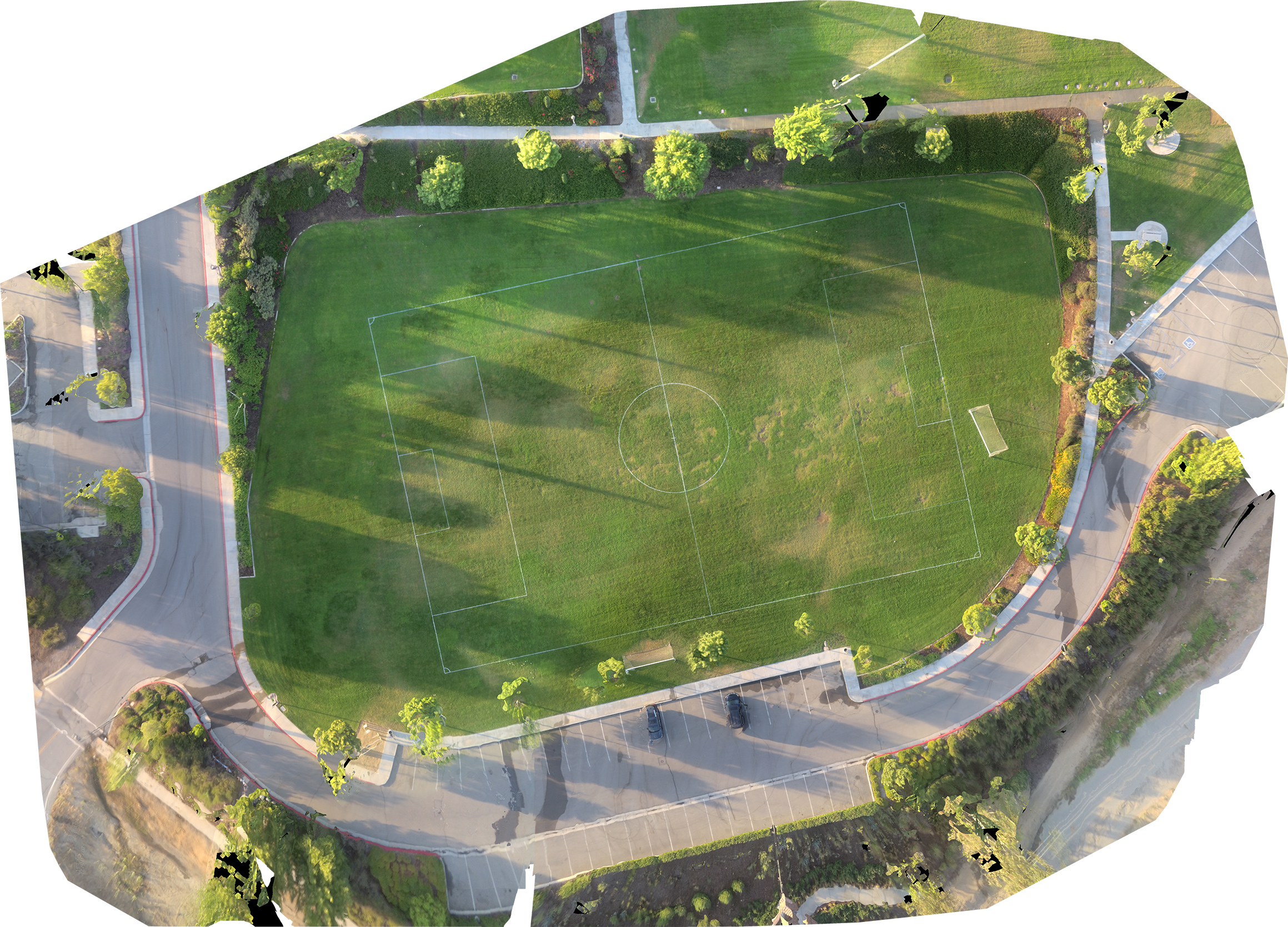
I took my latest frankenstein multi copter out to try and map the local park. Planned and uploaded the mission the night prior. It’s a small quad with a pixhawk mini, old DJI motors, and a Yi 4k action camera literally taped to it. Total of 96 photos taken at 30m, total mission time was about 10 minutes. My cheap telemetry crapped out so I just switched to mission mode after taking off and clearing some trees. Returned to me and landed within 6 inches of the initial arm/takeoff spot. Going to try and embed the photo and include a youtube video of the animation generated from pix4D, it’s 20 seconds long. Link to Youtube version of 3D Map.
Related topics
| Topic | Replies | Views | Activity | |
|---|---|---|---|---|
| Pixhawk autonomous Fly&motion recognition | 1 | 653 | February 28, 2018 | |
| 3D Printed 10" Quad. Pixhawk 5X. Build Log | 4 | 2067 | November 6, 2023 | |
| Flight Log Analysis - Drone Crash - Erratic Flight Height | 4 | 131 | November 8, 2025 | |
|
Mini + PX4 crash on mission mode -- help?
|
0 | 416 | May 21, 2017 | |
| Quadcopter Fly Away - Inaccurate Altitude Readings | 2 | 583 | May 26, 2021 |