I Mount Pixhawk Cube black on the drone and seeing data on the mission planner. We observed altitude reading not correct it shown wrong data and also store wrong data on SD card. some time it stores the correct reading on the Pixhawk SD card but on mission planner, it shows the wrong reading but mostly it showed the wrong altitude on mission planner.
I also try by connecting Pixhawk with USB and notice altitude on the mission planner but it shows again wrong altitude and altitude value also variable.
You need to head over to the Mission Planner forum at Ardupilot.
Yes Sir
Sir i have test pixhawk on the ground. my drone has a height of approx 400 meters. but in the mission planner altitude shown as only 6 meters.
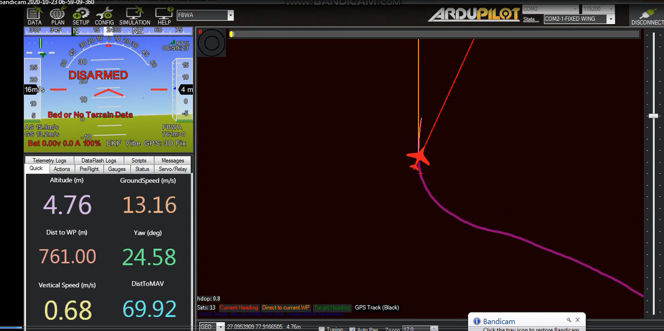
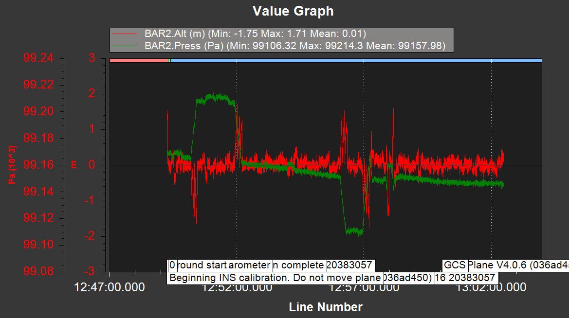
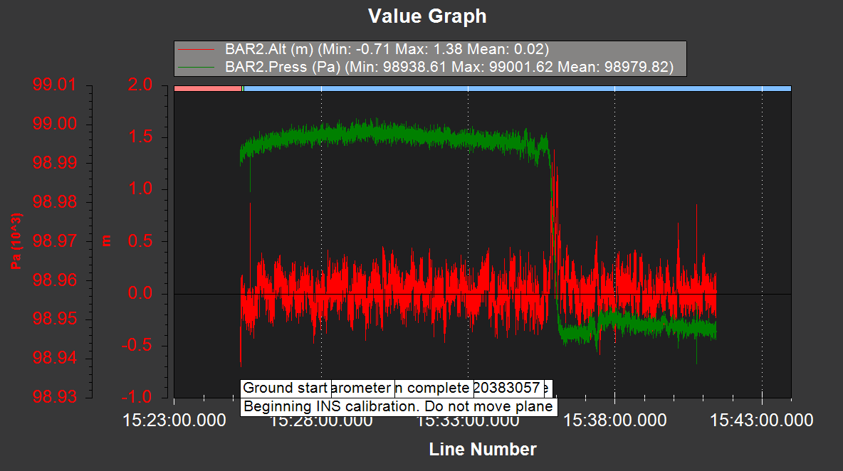
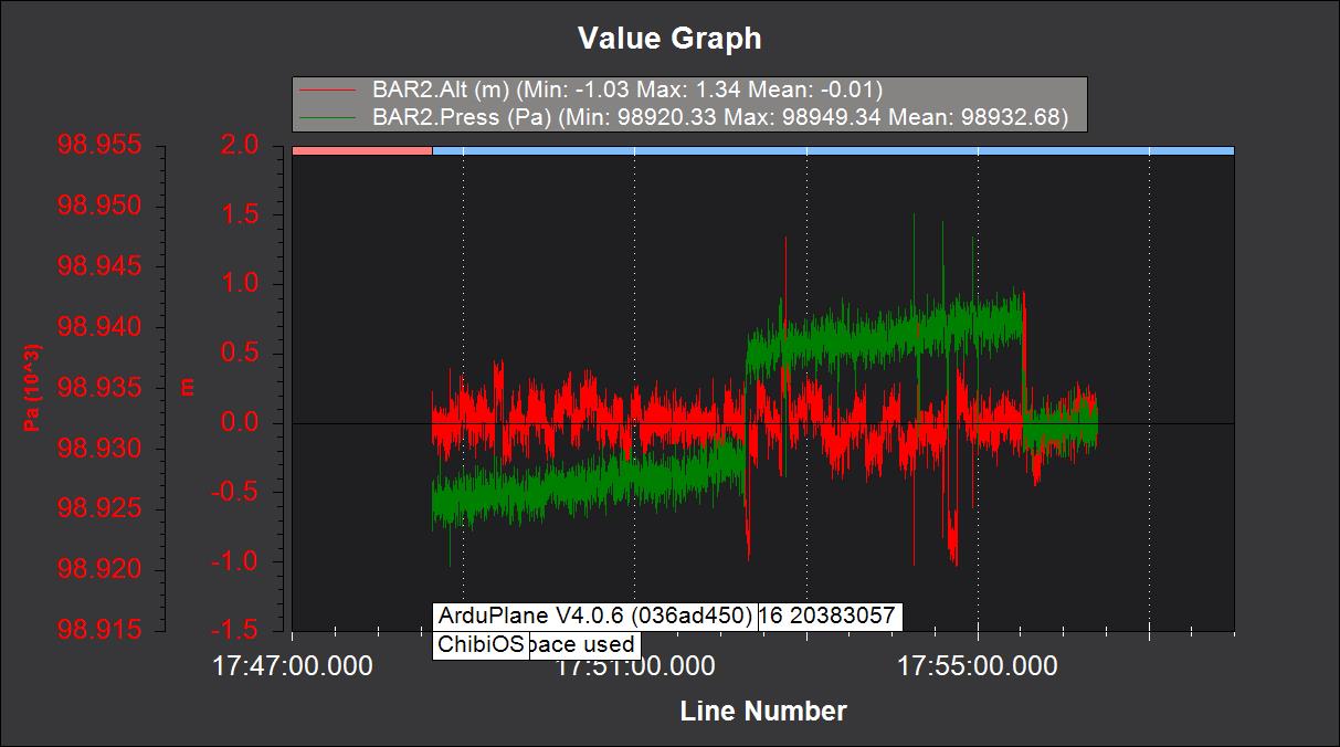
I have attached some images of the log data and mission planer screen.
on the mission planner is shown “Bad or No Terrain Data”
In the image red color shown altitude and green show pressure(pressure change according to height)
Mission Planner is not support here.
You will have much better luck here: