Hi,
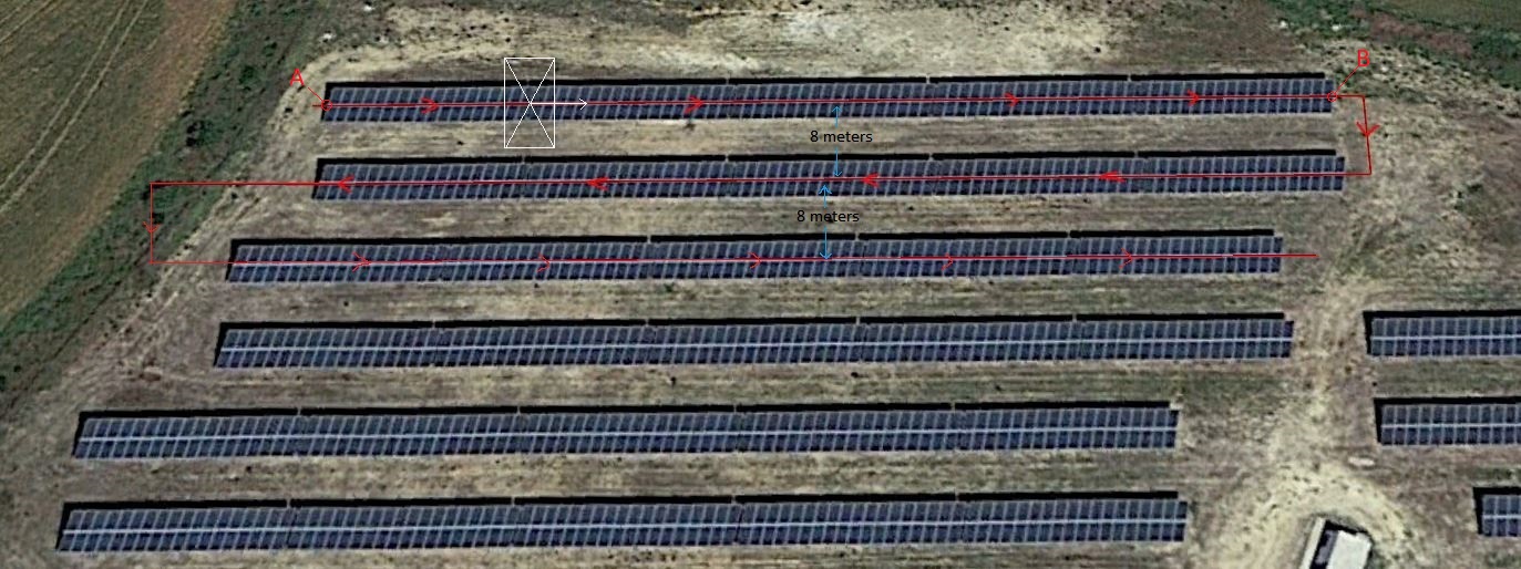
I’m trying to design the flight plan of a solar power plant aerial inspection with QGC. As you can see in the attached picture, the distance between the rows of panels is always 8 meters. We need to maintain the center solar modules strigns in the center of the picture and fly in the indicated direction.
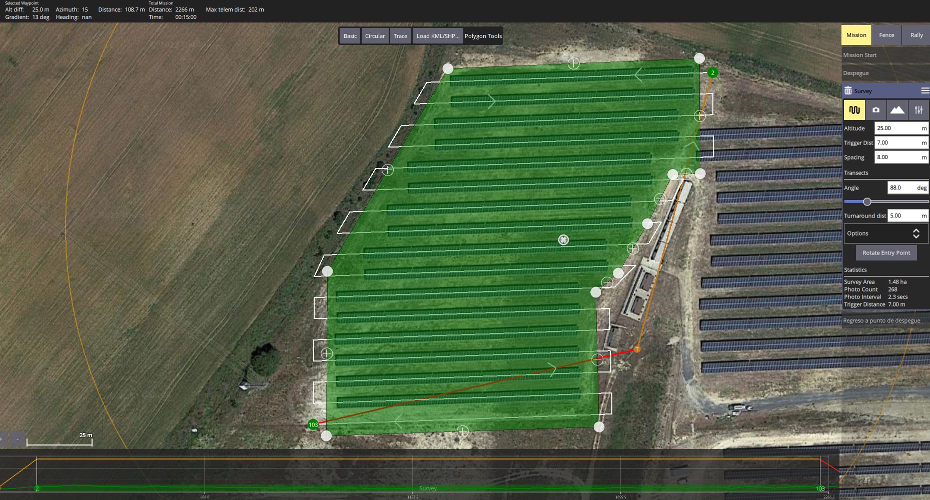
I’m taking the line between points A and B as a reference to make a survey flight pattern in QGC. I found easy not to enter camera specifications in the survey plan. Then set the spacing to 8 meters and the trigger distance I need to obtain the needed overlap.
But as we already know Google Maps coordinates are not very accurate. If I fly with this flight plan there is a good chance that the drone will not flight in the center of the solar modules strings.
To resolve this issue, I’m thinking to capture point A and B coordinates with a GPS connected to a CORS network before the flight. The accuracy will be in the order of 3 centimeters. But I dont know how to use these coordinates to correct the accuracy in the survey pattern flight plan.
Any helps will be really apreciated.
H.