HI
i’m using qgroundcontrol for the Bluerov2, after each session I have a TLOG files with telemetry,
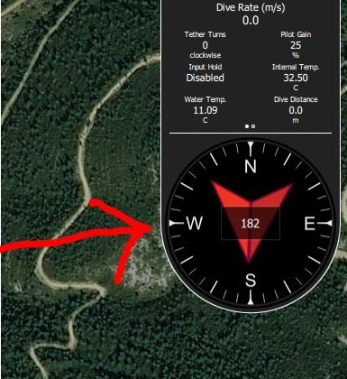
when I use qgroundcontrol or missionplanner to read the TLOG file I was able to see COMPASS degree (in this image 182°)
when I try to export data from TLOG file using missionplanner I can save it as TXT and then I was able to read it.
but where are compass data??? I found only the value of compass_variation but I can’t understand it…
for example:
02/02/2018 11:09:12 FE 16 0 0 F 1 1 C1 mavlink_ekf_status_report_t velocity_variance 0 pos_horiz_variance 0,01023314 pos_vert_variance 0,0003417233 compass_variance 0,02745412 terrain_alt_variance 0,0006562088 flags 485 sig Len 30
or
Line 802: 02/02/2018 11:09:13 FE 16 0 0 22 1 1 C1 mavlink_ekf_status_report_t velocity_variance 0 pos_horiz_variance 0,01017215 pos_vert_variance 0,008389785 compass_variance 0,02903016 terrain_alt_variance 0,0005503477 flags 485 sig Len 30
here the complete TLOG file (3MB) if someone could help me. download TLOG file 3MB
thanks
Mauro