Hi, I am new here and just recently learned about PX4 while researching “Follow Me” drones.
I am a software engineer, but have never done any coding for drones. I have done a bunch of reading regarding the “Follow Me” capabilities of PX4, ArduPilot, and others but I still have questions.
Below describes what I would like to do. Maybe someone can comment and tell me if it’s possible with PX4.
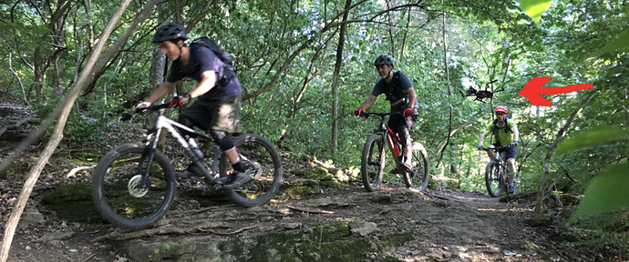
I am a mountain biker. I would like to have a drone with a GoPro follow me on the trails recording my rides. The idea is to make it seem like another biker is behind me with a chest mounted camera.
The functionality I desire is minimal (though clearly not “simple” to implement) …
- Follows me from behind.
- Min flight height from the ground: 2ft.
- Max flight height from the ground: 5ft to 6ft (basically just above my head).
- Min distance behind me: 5ft.
- Max distance behind me: 15ft.
- Max left or right drift from trail center: 2ft. (keep it within the trail width).
- Some means to guide the drone (help it follow me). GPS coordinates from a mobile device? Visual data? Some other platform or protocol?
Why the min and max heights? Within that range I theoretically should not have to worry about avoidance detection. My head is not riding into tree branches, so the drone should be safe. However I suppose I need to avoid collisions with the back of my head. ![]()
A “love to have” feature would be the ability to send the drone to a point 500 to 1,000 ft ahead of me down the trail to capture jumps or hard turns, then have it start following me again as I pass the drone.
I have a good friend who builds drones and will help get me started with my own build. If you think this is possible, I’ll start to really dig into learning how to implement PX4 on a DIY drone.
Thanks,
Chris
Something like this (I edited the drone into the picture) …


