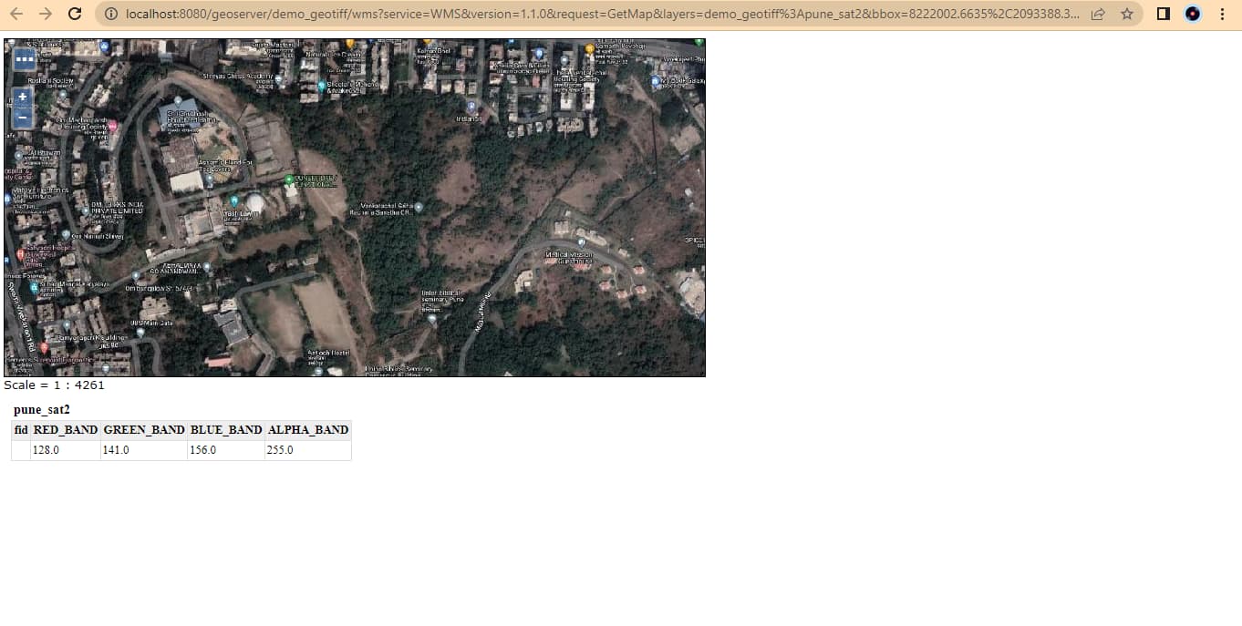
GenericMapProvider.cpp
static const QString serviceUrl = QStringLiteral("<serverUrl>/WMSServer?service=WMS&request=GetMap&layers=&styles=&format=image/png&transparent=true&version=1.1.1&width=512&height=512&srs=EPSG:3857&bbox=%1,%2,%3,%4");

QString serviceProvider::_getURL(const int x, const int y, const int zoom, QNetworkAccessManager* networkManager) {
    Q_UNUSED(networkManager)
    float north = tiley2lat(y, zoom);
    float south = tiley2lat(y + 1, zoom);
    float west = tilex2long(x, zoom);
    float east = tilex2long(x + 1, zoom);
    return serviceUrl.arg(west,0, 'f', 10).arg(south,0, 'f', 10).arg(east,0, 'f', 10).arg(north,0, 'f', 10);
}
float tilex2long(int x, int z)
{
    float n = pow(2,z);
    return (((x / n) * 360.0) - 180.0) * (20037508.34 / 180);
}

float tiley2lat(int y, int z)
{
    double n = M_PI - 2.0 * M_PI * y / (double)(1 << z);
    float lat = 180.0 / M_PI * atan(0.5 * (exp(n) - exp(-n)));
    lat = log(tan((90 + lat) * (M_PI / 360))) / (M_PI / 180);
    return (lat * (20037508.34 / 180));
}
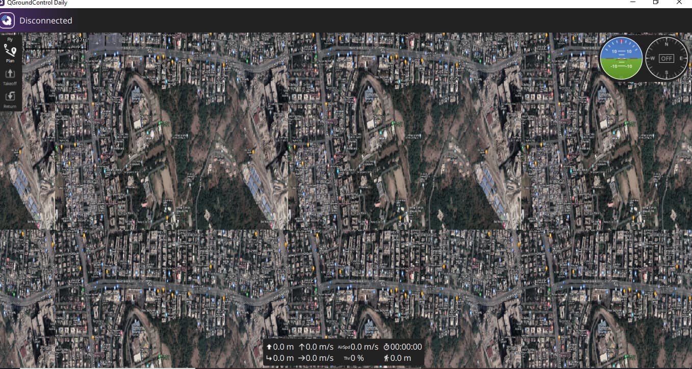
and this is what I inserted in FlightMap.qml file
_map is the base map from whatever has been selected in App Settings.
    Map {
        id: trafficMap
        anchors.fill: parent
        color: 'transparent' // Necessary to make this map transparent
        plugin:                     Plugin { name: "QGroundControl" }
        opacity:                    0.77

        property string mapName:                        'defaultMap2'
        gesture.enabled: false
        center: _map.center
        minimumFieldOfView: _map.minimumFieldOfView
        maximumFieldOfView: _map.maximumFieldOfView
        minimumTilt: _map.minimumTilt
        maximumTilt: _map.maximumTilt
        minimumZoomLevel: _map.minimumZoomLevel
        maximumZoomLevel: _map.maximumZoomLevel
        zoomLevel: _map.zoomLevel
        tilt: _map.tilt;
        bearing: _map.bearing
        fieldOfView: _map.fieldOfView
        ...
        ...
}
Here is the result
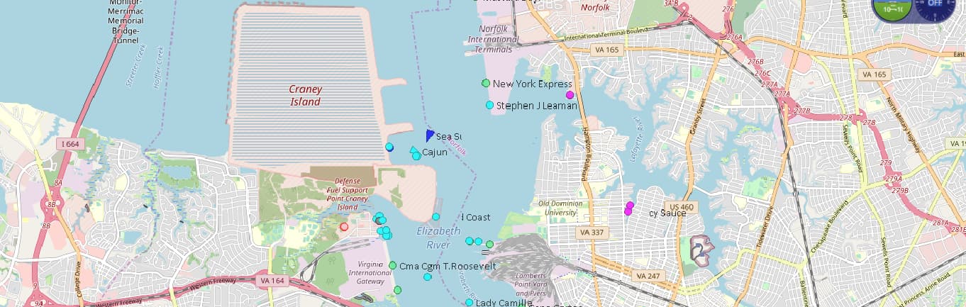
OpenSeaMap for my baselayer and the marine traffic on top! I used a simple timer to redraw the tiles for updated traffic info.