I need to know how to upload a .kml file as a map into QGround Control. My client sent me a .kml showing the area of interest that he wants to be surveyed. I need to be able to see what this area is in the QGroundControl software.
1 Like
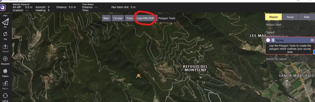
This is a step in the right direction, however this tool only allows me to upload a polygon as the mission survey area. I need to be able to see the kml file on the map in QGC to plan the mission. This is a problem because the client sent me hundreds of miles of lines that need to be surveyed. Not a polygon. I need to be able to see these lines in QGC
Unfortunately I think that this functionality is not implemented in current QGC stable release yet. However, developers have already included this option into master branch. You can track this issue here https://github.com/mavlink/qgroundcontrol/pull/5499.
The feature you are showing converts a mission to kml. Not the other way around.
reviving this question, now that we’re 3 years on and supposedly this functionality has been implemented…
The release notes for 3.4 state:
“Load KML Ability to load a KML file directly from the Sync menu. You will be prompted for what type of Pattern you want to create from the KML if needed.”
I’m running qgc 4.1.4 on Mac 11.5.2 and I seem to lack the “upload .kml” functionality that is described. Can someone tell me where I’m missing this?
thanks
Matt