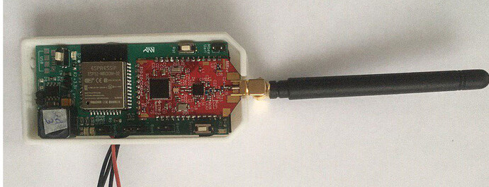
Hello. Once, our company faced the problem of controlling a large number of drones. The main problem was in the organization of communication. You need huge and expensive equipment. As a result, the idea was born to develop a communication channel that supports grid technology. During the operation, additional features appeared to solve the narrowly focused tasks of our small company. Now we have decided to appeal to the community. Probably, you will be interested in this functionality too:
Wi-Fi Mesh network.
Range of communication on WiFi on printed antenna 50m in the city and up to 400m in the field. Range 868MHz > 4 km in open visibility (in the field)
Retransmission capability*
Wireless upload of photo points *
Wireless downloading of logs *
Mobile application for device management
Synchronization in the cloud:
- Flight missions
- Points of photographing*
- Photos *
- Log files *
Setting up software modules from your phone via WiFi *
Built-in support for MAVLink.
Cooperation between devices without a base station*
Offline maps in the mobile app (Mbtiles)
Video transmission *
Implementation in power bank format (via OTG) *
Real-time trajectory collision correction*.
Connection to MP QGC via UDP
- something (*) that has not yet been implemented or in developing.
Not everything on the list is implemented perfectly.
How does it work now? The ground module is an access point
to which “operators”
such as mobile phones, or a computer are connected. There are two ways of communication presently: WiFi 2.4 GHz and FSK 868 MHz (at the moment, not a grid but a star with repeaters). Further, all control is carried out by UDP Protocol through MAVLink. We are going to publish a mobile application within 1-2 months.
The purpose of this message is to understand whether this product can help you or your company, to hear comments and suggestions.


