Hello everyone!!!
I am new with this pilot system. I am just wating for the arrival of the DeltaQuad to start the field surveys. I already have the simulation runnig and I understand how to add points or surveys on the QGroundControl interface, but we will have several diffrent missions spread across a very large area. If we have to add everypoint into the interface one by one it will be a big problem for us.
I am looking for a way to import GIS files like .csv or .gml or .gpx?
Thanks everyone and in the mean time I will be looking for some solutions.
Cheers,
João Lagoa
Patterns (Survey, Corridor Scan, …) can be generated from KML files (Load KML). No support for generating individual waypoints from KML.
Hello DonLakeFlyer,
Thank you for you answer, it helps a little bit but it raises more questions than it answers. I found where to upload the KML files but now I have two questions.
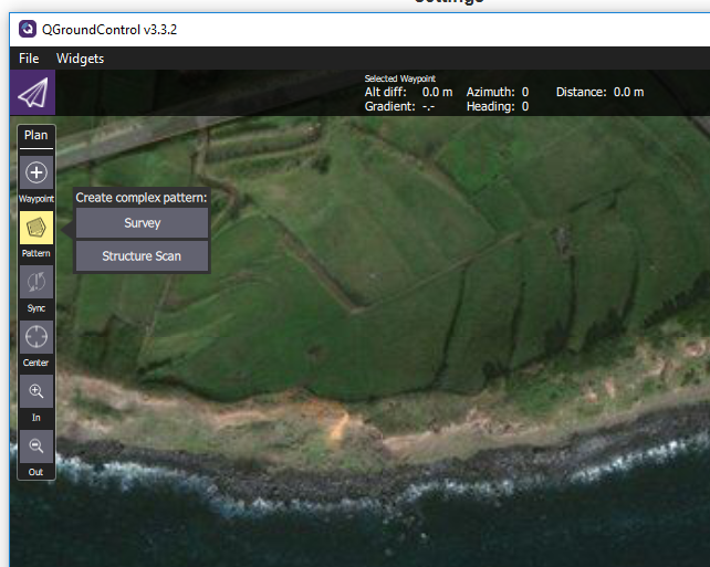
I) Does the interface accept lighter, simpler (text) files like .CSV or .TXT?
II) The option you refer as “Corridor Scan” sounds exactly like what I need but I can not find it. I only have “Survey” and “Structure Scan”. Is there an option that I have to turn on?
Again, thanks a lot for the help,
Cheers,
João Lagoa
QGC only support KML. Corridor Scan is available in v3.3 builds and newer.
I have downloaded the newest Stable Version 3.3.2 (Current) but I am still missing the Corridor Scan option.
Cheers,
João Lagoa
Sorry I was wrong. Corridor Scan is only in Daily Builds.