I am still new to UAV mapping but have found this forum to be a great source for advice and help.
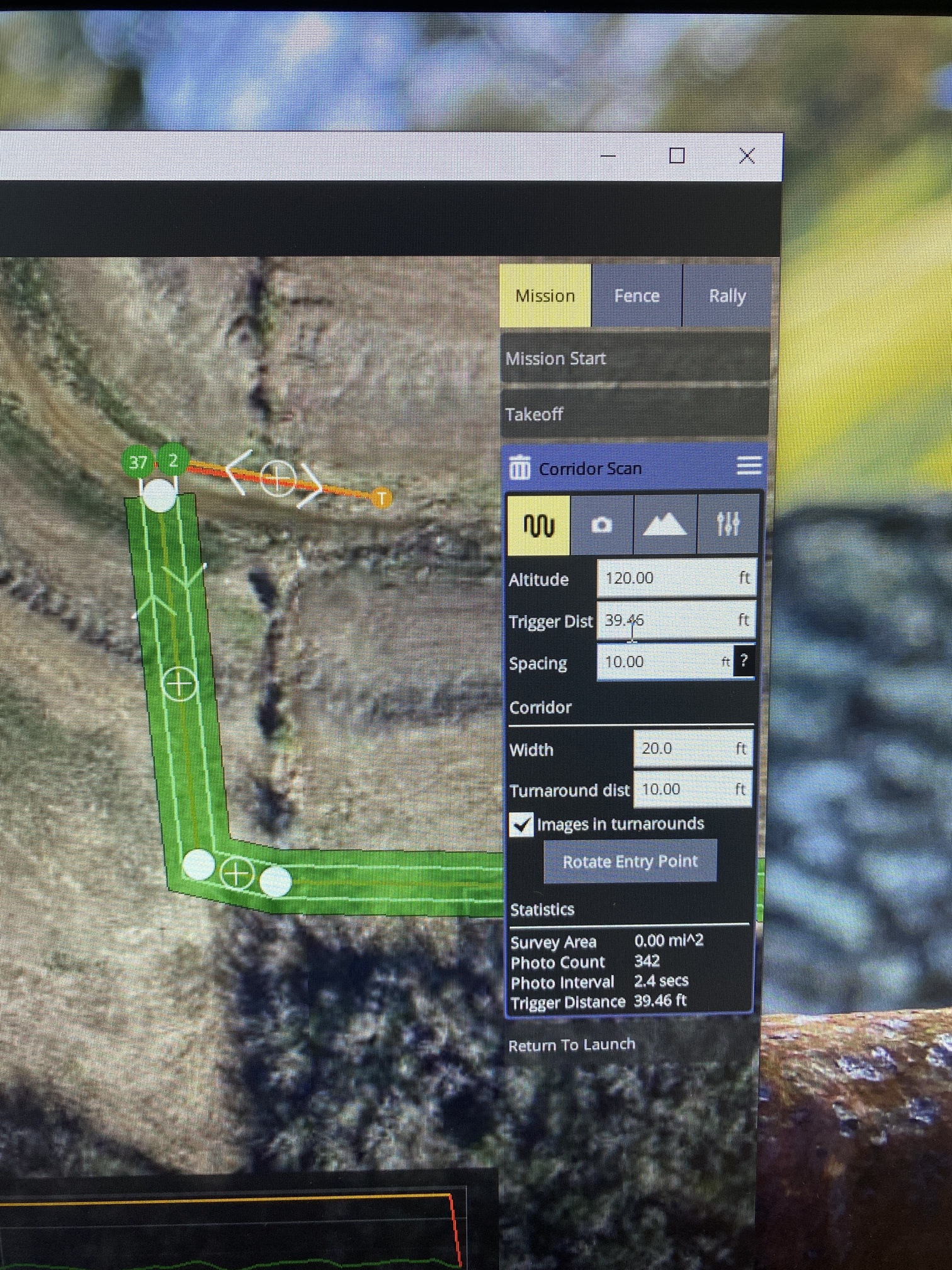
I have been preplanning my Corridor Flights on windows and then uploading them to my FreeFly Astro Herelink controller.
On windows I have the option to set the SPACING of the flights within the WIDTH of my corridor. So I can have a corridor WIDTH of 20 feet and a SPACING of 10 feet which will cause the UAV to fly 5’ off of my centerline (which is what I want).
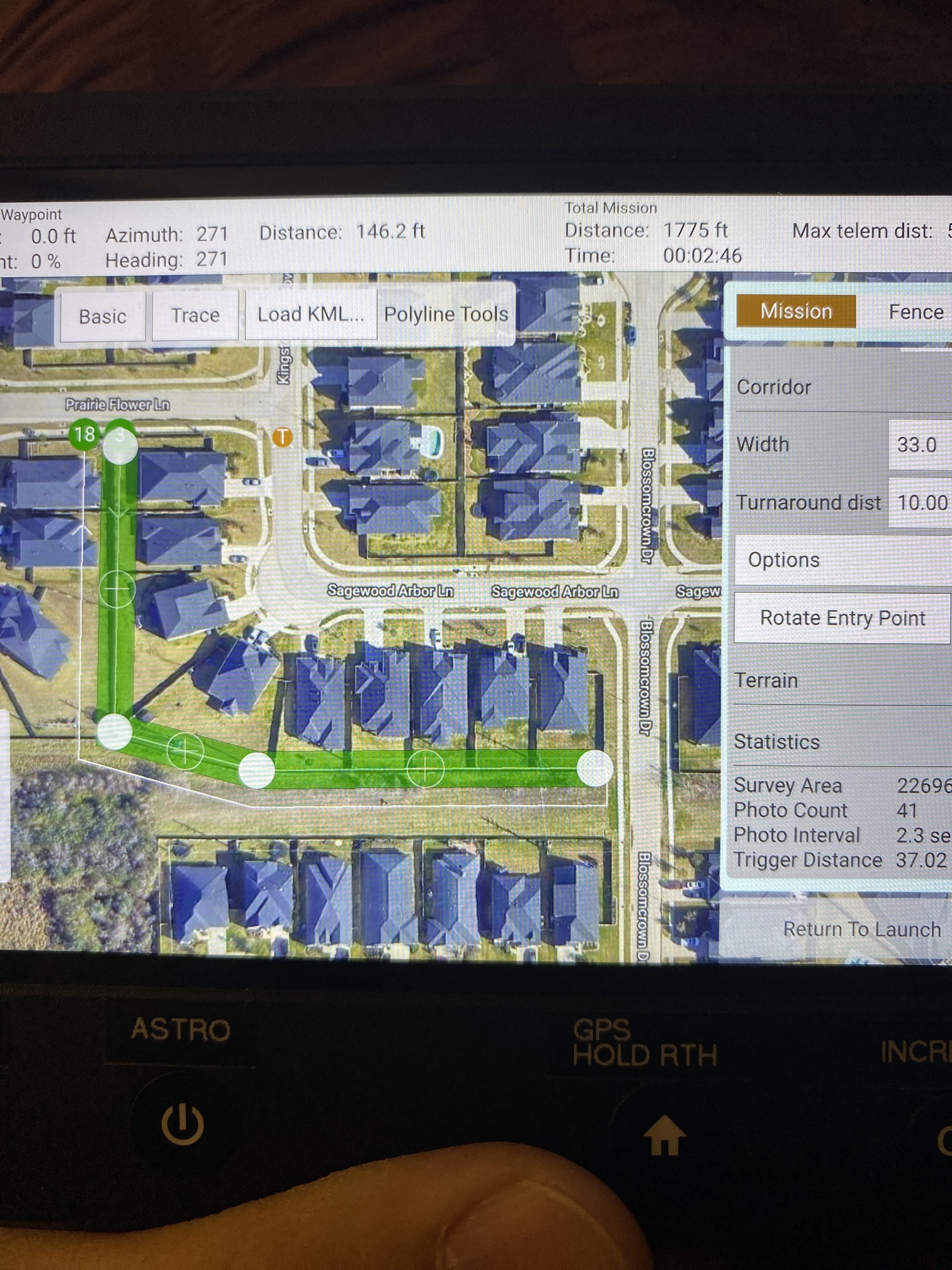
The android version does not have the SPACING option in V 4.0.8. Instead if I want the UAV to
make multiple passes down my corridor I have to set WIDTH to 33’ or above. However the spacing off the flight appears to set on path over my centerline and the other path is offset outside of my corridor WIDTH.
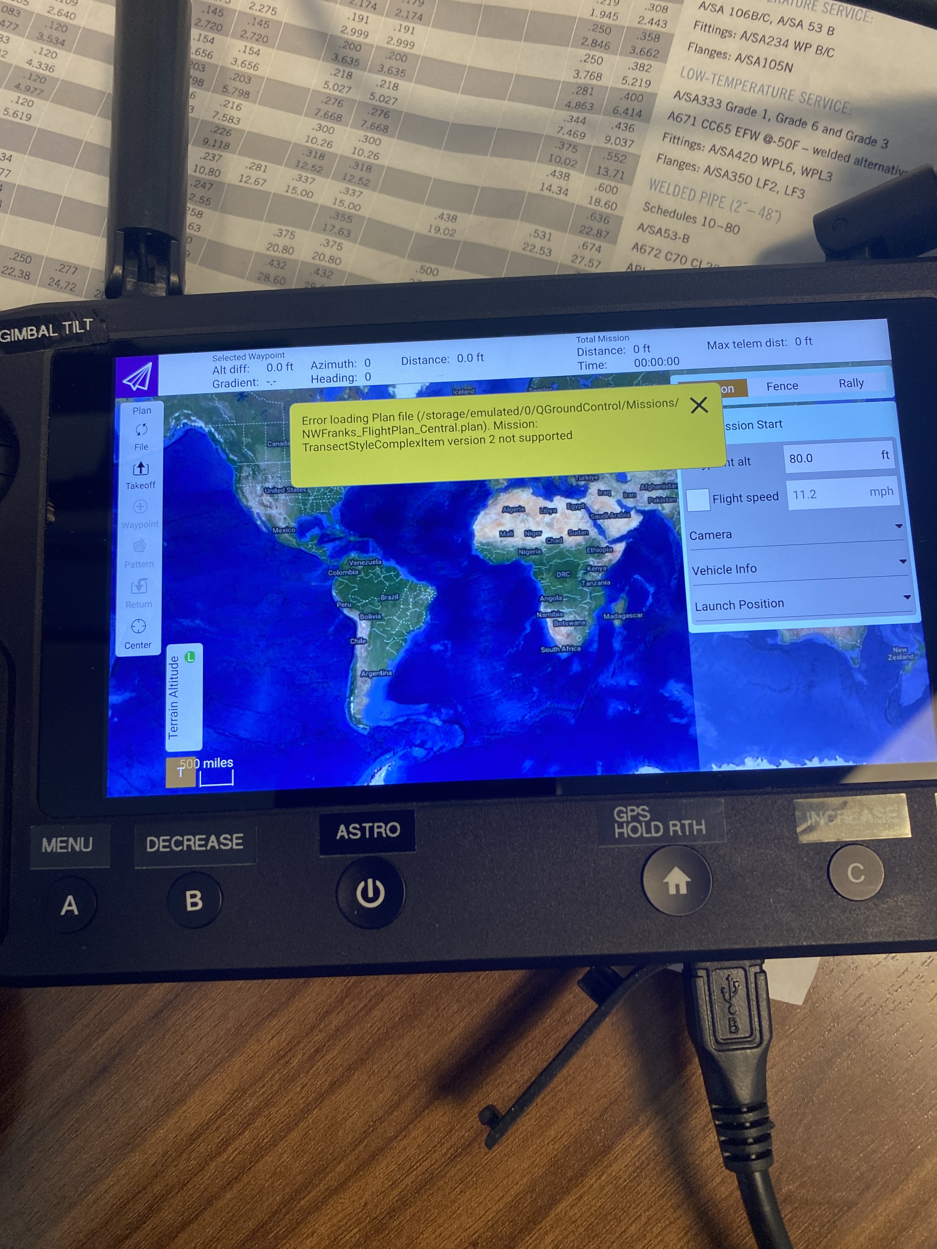
Also I am getting this error on my controller when loading the mission into QGC. I’m guessing it’s just incompatible versions between windows and android.
If anyone has any experience or advice on how to set the SPACING on the android version, it would be greatly appreciated. I hope this all makes sense.